Honda Magna Retro Logs

This is the written Log I kept for my 1984 Honda Magna, transferred to the blog.

St George to California, Day 7

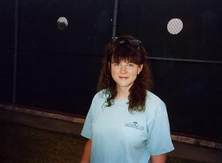
We left Tusayan and drove through the South Rim of the Grand Canyon about 10:00 AM and headed for home. It was on highway 89. Not much to see. Its mostly indian reservation & Dirty little towns. There seems to be more Stands selling indian jewelry than the homes they live in. We got gas at the Gap, travelled for a few hours till Jacob Lake where we gassed up again and ate. We loaded up, and headed for the final stretch home. The trip was over, and I know if we had more money Robyn would agree we’d have stayed longer. I was familar with the road home so I just opened it up and we did 80 most of the way. The best vacation I’d ever been on was over. It’d been like a dream we’d waited for since before we were married and it was done now. I was sad to see it end.

Total Miles: 1169

Total Money Spent: $635.00

Souveniers:

  • 2 Disneyland T Shirts
  • 2 In-n-Out burger T shirts
  • 3 route 66 T shirts
  • 1 Route 66 book by michael wallis
  • 1 Route 66 pin
  • 1 Disneyland Key Chain
  • $2 watch
  • 1 Disneyland book

Items Lost:

  • 1 bota bag full of water (somewhere on route 66)
  • 1 American flag (on route 66)
  • 1 watch (on splash mountain)
  • 1 thing of carmex
    [googlemaps http://maps.google.com/maps?f=d&hl=en&geocode=11440821376616549264,35.957290,-112.131900%3B16062662589442223005,37.109950,-113.583300&saddr=US-180+%4035.957290,+-112.131900&daddr=36.925743,-112.294006+to:E+St+George+Blvd+%4037.109950,+-113.583300&mra=dpe&mrcr=0&mrsp=1&sz=9&via=1&sll=36.564806,-112.563171&sspn=1.868426,2.927856&ie=UTF8&s=AARTsJqAfGosUXjkn8_qdJrrJP0GMYEsDw&ll=36.564806,-112.563171&spn=3.088333,4.669189&z=7&output=embed&w=425&h=350]

St George to California, Day 7 Read More »

Day 6: Route 66

Waking up in Kingman on Route 66We stayed at KOA in Kingman and headed out to my favorite stretch I’d been on yet. It wasn’t as deserty as the california stretch and the road was good. We stopped at Grand Canyon Caverns and at Seligman.

At Seligman I had the best burger I’ve ever had in my life at Juan Delgadillos Snow Cap. Juan is a nut. We took a walk down Seligman and found his brothers store, that had all sorts ofSnowball Palace, Grand Canyon Caverns route 66 stuff. We bought 2 T-shirts and a book, and talked for an hour or so. Seligman is a town that refuses to die, and it seems mostly due to the delgadillo brothers. Out of all the route 66 towns Amboy and Seligman seem to have the 66 spirit and wont let it die. The others don’t seem to care too much that I noticed, they were dealing with it.

Anyway, we took a few pictures and some info and left seligman. We passed the crooktown road exit and went into ash fork to get gas athe chevron station. Tried to find the road and bridge that was in the Rider magazine. We never found it. We crossed the railroad tracks, but I think we should’ve gone left instead of right. I was afraid of getting a hole in my tire, and wasnt all that sure it was, so we headed back through ash fork and said goodbye to route 66. On the way to williams, there was a really big abandoned stretch we noticed.Mummified Bobcat,  Grand Canyon Caverns

We went through Williams and the ride was great untill we got to the grand canyon. What a crowded tourist trap! We stayed just outside the park in Tusayan and it sucked. Windy, dirty and noisy. Helicopters constantly landing and taking off right next to the campground.

[googlemaps http://maps.google.com/maps?f=d&hl=en&geocode=17993792335159316445,35.527404,-113.432183%3B17089950981724175164,35.320728,-112.849290%3B1487652939200003640,35.967730,-112.129110&saddr=kingman+AZ&daddr=AZ-66+%4035.527404,+-113.432183+to:35.317366,-112.818604+to:US-180+%4035.967730,+-112.129110&mra=dme&mrcr=0&mrsp=2&sz=10&via=1,2&sll=35.290469,-112.723846&sspn=0.949413,1.463928&ie=UTF8&s=AARTsJrA2MgSicKspQazD69XdpZMPL18sQ&ll=35.541166,-112.994385&spn=1.564398,2.334595&z=8&output=embed&w=425&h=350]

Day 6: Route 66 Read More »

Day 5: First Day on Route 66

Robyn at Roys on Route 66
Robyn in 1991 at Roy's in Amboy

Rode 404 miles today.

We left Anaheim about 10, somewhat reluctantly. Disneyland for 2 days was a blast. We rode splash mountain 5 times (one of which I lost my watch on) and if the park wouldnt have closed at 10 instead of 1 AM like we thought, we wouldve probably done every ride twice. We could have spent a week there.

Anyway, we took highway 5 to 405, north on 55 onto 91 and then 1-15 North. We got off on a part of route 66 near Cajon pass. It was only about 8 miles but it already showed a few casualties of the interstate. It was once a two-laner and I think we missed a little of it and couldve found more. Then it was 1-15 through to Barstow. At Dagget, we found old trails highway, ol’ route 66 again. we went through newberry springs, a little town practically under the 1-40 underpass and stopped 30 miles later at ludlow to get a gatorade. 1/2 hour later, we were in Amboys at a place called Roys. Its owned by Buster Burris, who said he’d been there 50 years. He was rad! We ate, bought a T-shirt, talked for a while about route 66 and headed for cadiz or chambless to get gas. Then, we went through goffs, a shmeggy little place buster showed us that was the OLD route 66. Then it was to 1-40 untill we hit Topock. I know we missed alot of it.

We rode through Oatman, and old ghost town that had closed down by the time we got there, but did have a sarsparilla and headed out. Oatman and goldroad was pretty interesting. At one time it had 10,000 people and now it has 100 people…… maybe.

Rode into Kingman for the night to the KOA. Windy day, but a nice ride.

[googlemaps http://maps.google.com/maps?f=d&hl=en&geocode=7496869689303502543,33.832830,-117.919180%3B15118096633822049589,33.774681,-117.860081%3B2566601709567911381,34.253809,-117.459432%3B446161051617951934,34.347216,-117.468695%3B9071864067465498029,34.732010,-117.326530%3B2626768883307202373,34.885910,-117.029950%3B15563764665090701006,34.555420,-115.756240%3B11155277860971333610,34.828370,-115.051380%3B14065704722403104914,35.190600,-114.064000%3B7952691562820891419,35.021510,-114.382950&saddr=S+Harbor+Blvd+%4033.832830,+-117.919180&daddr=S+Parker+St+%4033.774681,+-117.860081+to:Cajon+Blvd+%4034.253809,+-117.459432+to:I-15+S+%4034.347216,+-117.468695+to:National+Trails+Hwy+%4034.732010,+-117.326530+to:I-15+N+%4034.885910,+-117.029950+to:National+Trails+Hwy+%4034.555420,+-115.756240+to:National+Trails+Hwy+%4034.828370,+-115.051380+to:35.029996,-114.375916+to:W+Beale+St+%4035.190600,+-114.064000+to:CR-153+%4035.021510,+-114.382950&mra=dpe&mrcr=2&mrsp=8&sz=9&via=1,2,3,4,7,8&sll=35.041241,-114.400635&sspn=1.904607,2.927856&ie=UTF8&s=AARTsJpGwnVIqVEYBVDpMe_xCbhcZ5vh9A&ll=34.660322,-116.026611&spn=3.162626,4.669189&z=7&output=embed&w=425&h=350]

Day 5: First Day on Route 66 Read More »

Day 2: St George to California

This morning I met a guy with a 1950 Indian chief, pristine condition. He told me that when his father died, there were 2 they found in the crates. Amazing. Someday….

We left Barstow K.O.A. around 9:30 AM and headed off to forage for food, and ate at the must advertised “bun boy”. After getting gase we were on the road & on Old US 66 out of Barstow, now called national trails highway. Anyway, we lost route 66 in Victorville & Got on Hesperia road to naturally… Hesperia.

Through Silverwood Lake was heavily wooded. Winding and steep switchbacks that were gorgeous. From then on, it was freeway. We did damn good with that map holder on my gas tank bag. we only had to stop once to figure out where to go & only because we couldnt

look at it long in heavy traffic and read it wrong. Anyway, another great investment.

We ate at In n Out Burger in Lake Elsinore & picked up a few T shirts & headed off to the coast. The ortega highway is another nice ride. When I was there 2 years ago with Randy it had recently been burned pretty bad and was mostly charred but has since started to grow back and gotten much greener.

Magna Trip with Robyn, 1991.  Disneyland Campground

When we hit the coast, I got us on PCH, and untill we hit anaheim it was clutch hand hell. Im surprised my clutch survived, but my left hand barely did. Too much traffic. Certain spots were beautiful though.

Right now we’re in Disneys Vacationland Campground. Its grassy and has everything a motorcycle enthusiast could want. As soon as Robyn gets out of the shower we’re heading to breakfast and spending the day at disneyland. Last night we ate at “the catch”, a seafood restaurant. I had the swordfish and robynski had the halibut. It cost us 50 bucks.

We drive 245 Miles Yesterday.My hawt wife Robyn!

[googlemaps http://maps.google.com/maps?f=d&hl=en&geocode=16469399352381723208,34.888000,-117.071460%3B9071864067465498029,34.732010,-117.326530%3B1673442746931558215,34.471030,-117.272750%3B3236852036921943877,34.308799,-117.333212%3B6679909359355039121,34.215660,-117.286260%3B14536961486705391929,33.854138,-117.535566%3B4378269771213891788,33.648910,-117.373820%3B3576713360860320751,33.466420,-117.702250%3B11059339708135278816,33.612690,-117.889390%3B15499295875927492390,33.738640,-118.090120%3B12248636453758346096,33.774310,-117.920090&saddr=Barstow,+CA&daddr=W+Main+St+%4034.888000,+-117.071460+to:National+Trails+Hwy+%4034.732010,+-117.326530+to:Bear+Valley+Rd+%4034.471030,+-117.272750+to:CA-173+%4034.308799,+-117.333212+to:CA-18+%4034.215660,+-117.286260+to:34.197037,-117.118378+to:I-15+S+%4033.854138,+-117.535566+to:Ortega+Hwy+%4033.648910,+-117.373820+to:Pacific+Coast+Hwy+%4033.466420,+-117.702250+to:East+Coast+Hwy+%4033.612690,+-117.889390+to:Pacific+Coast+Hwy+%4033.738640,+-118.090120+to:Harbor+Blvd+%4033.774310,+-117.920090+to:anaheim+CA&mra=dpe&mrcr=0&mrsp=6&sz=10&via=1,2,3,4,5,6,7,8,9,10,11,12&sll=34.277645,-117.202148&sspn=0.541283,1.262054&ie=UTF8&s=AARTsJqgyMUZX0obCTjM-ZrNMOqjdhdPaA&ll=34.277645,-117.202148&spn=1.588615,2.334595&z=8&output=embed&w=425&h=350]

Day 2: St George to California Read More »

St George to California, Day 1

Heading outWe left St. George at 4:45 pm and stopped by to drop off Vern’s truck, and was on the road a little after 5. It was really windy through vegas, and coupled with the fact I’m never in a very good mood when I first leave on trips, it wasnt a very good ride. We gassed up in Glendale, ate at Jack in the Box in Vegas, Gassed up in Jean, and when we hit the California state line it was possibly the best ride i’ve had yet. It was cool, the sun was behind the mountain and no more wind. The Magna seemed to purr. We were rocking out on hawg trip tapes and I started to realize My wife and I were on Vacation! We gassed up in Baker and headed on to barstow. It was around 11:00 St George Time when we pulled into Barstow. We had to go back because we missed the KOA 5 Miles back.

Our camping equipment is great! we wondered how we wouldve gotten along w/o it.

Anyway, we rode 285 Miles last night. We\'re off!

[googlemaps http://maps.google.com/maps?saddr=Saint+George,+UT&geocode=&dirflg=&daddr=Barstow+CA&f=d&sll=37.147182,-113.583527&sspn=0.245198,0.630341&ie=UTF8&s=AARTsJp-2dxpT14HSIFTokCFgoUY1sGJTw&ll=35.995785,-115.290527&spn=3.11083,4.669189&z=7&output=embed&w=425&h=350]

St George to California, Day 1 Read More »