
Route 66 / Easy Rider with My Daughter Megan

Friday June 6 2008
 Asked Meg if she wanted to go for an overnighter to Caliente Nevada and be back by noon on saturday. She said yes, so we went to northern Arizona instead. Theres nothing to do in caliente, thats a ride to do by myself.
Friday around 3pm we loaded up, and headed out with one saddlebag of stuff. The other saddlebag had a tent and 2 sleeping bags. We were going hardcore: ride hard, sleep on the ground! oowrah!
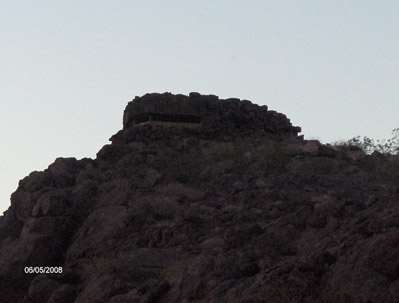
The weather was nice and warm, but pretty windy. Gusting Bike-leaning windy. We went through overton and behind lake mead, and over to hoover dam to get to kingman. We stopped on the Arizona side and took it all in, and took a break to stretch our legs and I noticed a pillbox on top of the hill. I figured there must more on other hills, but didnt see any, and the area was blocked off so I couldnt get up there. The lady inside told me it was the last remaining from WW2. Back then, like today the hoover dam is a place of high national security. In one of my pictures you can see the new bridge theyre building across the colorado to protect the dam more. Im sure theyll convert to a tram system like they did at Zions.
 We got into Kingman around 10 and my nav or google maps wouldnt work on my phone so had a helluva time finding the campground. Robyn as usual was the most reliable option, she helped us out. Damn verizon. My phone comes with a built in GPS, but verizon disables it so its dependent on their network now.
Anyway, after getting to the campground, and 2 more unorganized trips to get a flashlight to set it up, and another to get food, we finally crashed out and we sleeping on the ground like we’d planned. Im too old for this. I need a bigger bike where I can bring an air mattress. Even so, it was a cool experience. Havent slept in a tent for years, and the first time we’d slept in those tiny mummy bags was when robyn and I slept in them at the same campground in 1991, 17 years earlier.
We rode 250 Miles that Day.
Hackberry, Seligman, Grand Canyon Caverns and Kingman:Saturday, June 7 2008
 Slept ok, but we both woke up early so we broke camp and headed to get breakfast at Denny’s. Today was a mellow day, we had about 170 miles to ride and all day to do it. After breakfast, we took our time, drove around Kingman a bit, took some pictures of Trains and Old route 66 Motels, then headed north on the mother road.
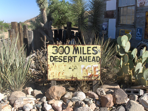
I dont really remember the hackberry general store when I first hit route 66, but wanted to see it now. It wasnt open for yet another hour, so we just looked around and then headed out again. The ride was nice, windy still, but it had that feeling that it was early morning on the first real day on vacation, and with my daughter with me, it made it even better.
The next stop was the Grand Canyon Caverns. Meg had been there before, but didnt remember it, so we took the tour again. It struck me how much Route 66 has made a comeback, even in the 20 years or so that I’ve been interested in it. The guide told us that before the bypass in 78, they did 500 people a day, then overnight, nothing. Now its doing well again, and the tours are going strong. They do around 150 people a day steadily, enough to keep it going well and keep jobs going in the area. Pretty cool.
Then we hit Seligman. Everyone knows the snow cap, and as we pulled u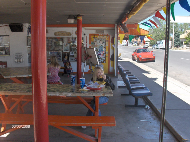 p the place was packed. Still, the BEST hamburger ever made, period. Juan’s kids are running the place and have kept up the tradition, enough to make my 13 year old daughter laugh and have a good time. They even spotted me the 3 bucks I was short (I went and got them the money later), PLUS they had a terrible towell, signed by Big ben himself right inside the window. I couldnt be any more loyal now.
we went down crookton road, and crossed the free way to see the Partridge creek bridge again. Took a breather, then headed east through williams, parks, and to the harley dealership in Bellemont. I finally was able to get internet on my phone, so looked up the overnight low in Flagstaff, and decided 40 degrees was a hair too cold in a tent for my daughter. So I called Robynski and she was able to book us a room. Apprantly the night before there were NO rooms in flag for under 200 bucks, but whatever convention or whatever was gone now, so she got a room with no problem. While at the dealership, Meg and I sat on a 2008 Ultra classic. Megan decided she loved the back seat. Dammit, I gotta get one. Granny glide or not, I want to tour and don’t want back seat comfort a problem. Im hoping its comfortable enough Robyn will want to go ALOT once the kids grow up.
after we left the dealership, we went a quarter mile down the road to the pine breeze inn. Whats that? In the opening scenes of Easy rider, toward the end of the opening credits Wyatt and Billy go to get a room and the guy shuts the door and turns on the no vacancy sign.

Well, its in Bellemont. Looks like this now: 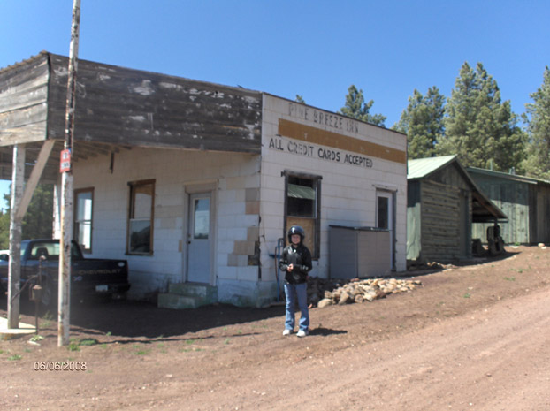
Someone is trying to turn it into an RV park now, hopefully it flies, and he restores the building. It had an easy rider poster on the wall and some inside too, so the guy is a fan. Here’s another screenshot from the film, and if you really want to geek out, you can watch the whole intro. The pine breeze inn is the last sequence.
From there, we headed the 10 miles into Flagstaff. We parked at the hotel, and within seconds 2 drunk indians stumbled across the street, and one passed out within a foot of my bike. Kind of awkward, I pretended I didnt see him and got my daughter inside the motel as quick as I could. He was there 15 minutes later when I decided it would be best to move the bike. Nice motel, i thought.
After a full days riding, I thought I had meg wore out, but she doesnt go down without a fight, so we kicked back for an hour, then went and saw the new Indiana Jones Movie. After that, headed back and I was asleep within an hour.
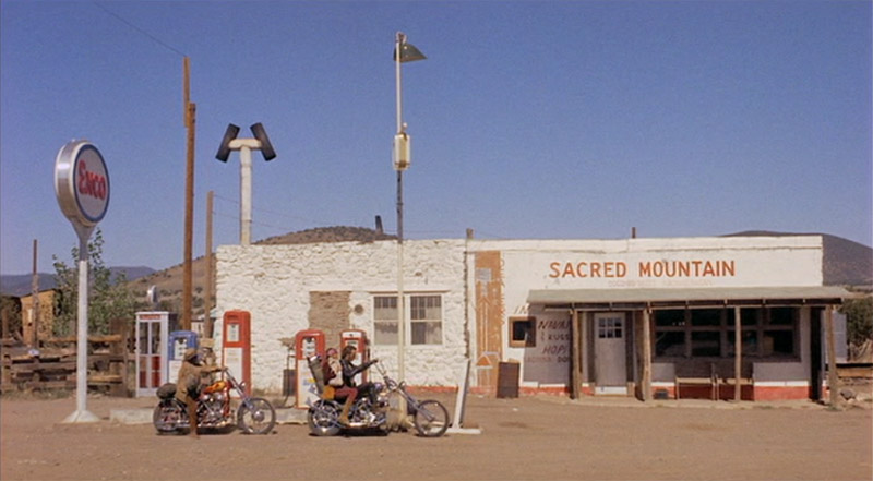
Sacred Mountain Gas Station from Easy Rider: Sunday, June 8 2008
We woke up, had breakfast at the motel restaurant (aptly named “hogs”) and then hit the road. At the bottom of mountain outside flagstaff was another Easy Rider Icon I was wanting to see, so we stopped again. Here’s the picture from the movie:
And here it was, this Morning:

A guy who must live there popped his head over the wall and confirmed that this was the one from the movie (the pictures pretty much confirm it) and he also told me about another little stretch they rode that was in the movie through wupatki national monument, 5 miles away. We needed to head out, so I’ll go check it out another time. Im wondering if it was the scene where they slept in the ruins, I bet it was. Its been a national monument since before then, and the story goes the park ranger watched them like a hawk as they filmed. Now that I type this, that makes sense. I’m nearly sure thats the place.
 We stopped at Cameron to get get some water, rest our butts a bit then flew on to Marble canyon, another hour away. We stopped for a minute to check out the old Bridge spanning the colorado river, built in 1927. It was a pretty big deal that bridge. The grand Canyon and the colorado river is still a major obstacle today, and building that bridge was huge. Before that, Lees ferry was the only way to cross the colorado for hundreds of miles.
After that, we went over the bridge to marble canyon and ate lunch, and fueled up again and headed for the home stretch. It was a little cold over the Kiabab, but nothing too big of a deal. From there, it was pipe springs where we made our last butt resting stop, then opened it up and made the last hour home.
I had a blast. I love it when my girl’s go riding with me. We don’t spend alot of one on one time together, and when we can do 2 or 3 days at a time traveling together and enjoying each others company it means the world to me. I couldnt ask for better kids. I hope they never get tired of going with Dad on motorcycle trips.
Ride Totals: 702 Miles, 3 days, 3 States.
Click Here to See the entire route from the 1969 Movie Easy Rider
[googlemaps http://maps.google.com/maps?f=d&hl=en&geocode=17526175772437010747,37.074970,-113.870840%3B10611033257320649261,36.350623,-114.483584%3B10570349919971796927,35.197660,-114.076820%3B4768846377653548125,35.491950,-113.548680%3B3075036505602002716,35.287940,-112.729520%3B15653700821007671750,35.251580,-112.185090%3B17736504140395952768,35.261005,-111.980544%3B5105633944270891746,35.186592,-111.629685&saddr=Santa+Clara+Utah&daddr=Old+US-91+%4037.074970,+-113.870840+to:Northshore+Rd%2FNV-167+%4036.350623,+-114.483584+to:US-93+%4035.197660,+-114.076820+to:AZ-66+%4035.491950,+-113.548680+to:Crookton+Rd%2FHistoric+US-66+%4035.287940,+-112.729520+to:Historic+Route+66+Loop%2FI-40-BL+E+%4035.251580,+-112.185090+to:CR-146%2FE+Old+Hwy+66%2FE+Parks+Rd%2FParks-Wagon+Wheel+Rd+%4035.261005,+-111.980544+to:I-40+E%2FPurple+Heart+Trail+%4035.186592,+-111.629685+to:37.116526,-113.587646&mra=mi&mrcr=2&mrsp=9&sz=7&via=1,2,4,5,6,7&sll=36.129002,-111.741943&sspn=3.859441,9.624023&ie=UTF8&s=AARTsJq4f89iv-PwlriSu7AmbjsAnbvPEA&ll=36.164488,-113.049316&spn=3.104166,4.669189&z=7&output=embed&w=425&h=350]
Route 66 / Easy Rider with My Daughter Megan Read More »


