Route 66 with Wendy
This weekend, it was just nice. All day friday I was kicking around thoughts of heading somewhere to get some ride time in, and around 3 on friday I came home, and asked if Wendy wanted to go. She did. Headed out around 3.
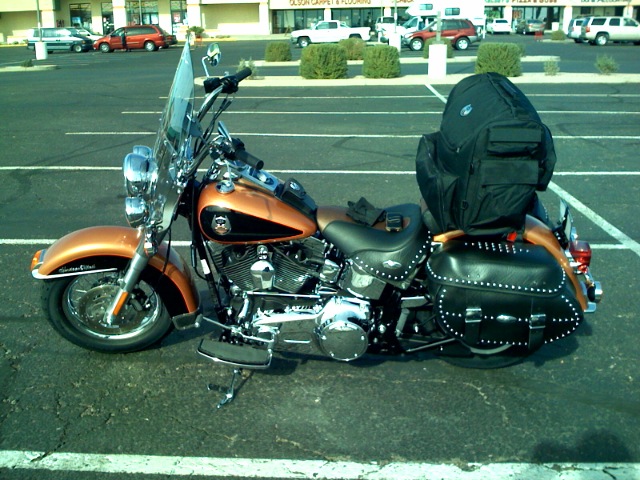
Wendy is a pro. Last year we loaded up and rode to Universal Studios on the bike in the heat of the summer, and she was a blast to take. Doesnt complain, and loves riding. I love the one on one time. I didnt have a ton of one on one trips with my Dad, and the one I did always meant alot to me. Its one of the reasons I bought the bike. I hope its a memory that means something to my girls. Not alot of 11 year olds can say theve ridden thousands of miles on a harley davidson and seeing their world. Thats my delusion anyway. We’ll see.
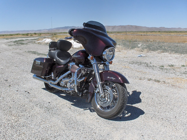
 Wendy, at hoover Dam. Friday, May 16 2008
 Wendy loves Hotels. She played her DS and even talked me into going swimming for a few. We crashed that night, and woke up to get some road behind us.
Kingman is a cool town to me for some reason. Its got alot of route 66 flavor, and its got all the modern conveniences. Plus its a gateway to  alot of my favorite roads. to the east is Seligman, and a great old stretch of 66. the west is a great bike road through oatman, and california. I like to ride for kingman and decide which way Im going to go when Im at the intersection, and its usually always a great ride.
for the sake of time we went to oatman. Wendy had never seen it, and I thought she might like it. We headed out, and took the winding road up to oatman. There was a live wedding in the street, which was kind of cool to see. Ive seen a few gunfight shows, but not a wedding.
 Oatman is one of the most unique towns, if not the most unique that I’ve ever seen. Around the turn of the century it was a booming mining town, and it still holds that feel. If it had a dirt street, I cant imagine a wild western town being much different. When the mines stopped producing, the miners left their burros and theyve thrived in the desert without any natural predators, and they still roam the streets.
Wendy found a ragged old cat, that apparantly liked to fight. His owner said he would leave for days and would come back all cut up, and would even take on coyotes and whoever crossed his path. Wendy made immediate friends. She has cat mojo. I even liked this cat.
Clark Gable and Carol lombard had their honeymoon at the oatman hotel. The hotel is a museum now, and we checked it out. Ive been to oatman a bunch, but that was the first time I’d been in the hotel. Theres even a tattoo shop there, but I didnt go in. Maybe I should check him out next time.
After about an hour of Oatman, we headed for the colorado river through Topock, then onto Needles. Wendy was beat. I made the mistake of not switching out a touring seat for my bike, and we both had a bad case of TB. We ate at dennys, and called Robyn to tell her we would head home. It was pretty hot, and Robyn and I had a Penguins NHL playoff game at 1pm, so I figured we’d head back. But I REALLY wanted to go to Amboy. Albert Okura had bought the town, and its one of my favorite spots on route 66, and a couple of weeks ago, they finally got the gas station open after a couple of years of work and about 750 grand. At the crossroads, I decided to spend another day, go to Amboy, and spend the night in Barstow.

Luckily, Ive got the best wife in the world. I called her and she got us a room in Barstow. We pulled in through record heat into Amboy and drank about a gallon of water and hung out for about an hour or so, resting our butts and hydrating up.
A tour bus overturned just east of ludlow, and eastbound highway was routed from I 40 down old 66. It was actually pretty cool to see Roy’s get so much business, and I couldnt help but thinking thats how it mustve been before it was bypassed in the early 70s. Even so, the one guy watching shop went out of his way to give Wendy a Roy’s T shirt for no charge, which I thought was really pretty cool. Ill always swing wide for Roys. Albert Okura paid 400k f or the town. It’d be nice to have that kind of money, I’d like to own a town one day. Someday…..
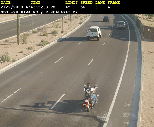
We headed over to barstow, and just relaxed. Wendy was beat, and so was I. We woke up in the morning and made time to get back to st George, by 1pm, and made it. All in all, we’d rode 760 miles in less than 48 hours. Wendy is my riding buddy. I hope she had a good time. I know I did.
Ride Totals: 722 Miles, 4 States in 2 1/2 Days
[googlemaps http://maps.google.com/maps?f=d&hl=en&geocode=5460195716597490523,37.070312,-113.877478%3B13014085877754107342,36.242780,-114.516390%3B11101874023695939221,35.207280,-114.098580%3B11934177521479792722,35.028720,-114.385900%3B4745915673430077905,34.841580,-114.612180%3B4815941953477700613,34.643110,-115.378580%3B12907642574802950246,34.577006,-115.848759%3B990865054233882008,34.886060,-117.013170&saddr=Santa+Clara,+UT&daddr=Old+US-91+%4037.070312,+-113.877478+to:Northshore+Rd%2FNV-167+%4036.242780,+-114.516390+to:US-93+S+%4035.207280,+-114.098580+to:CR-153+%4035.028720,+-114.385900+to:I-40+W+%4034.841580,+-114.612180+to:National+Trails+Hwy+%4034.643110,+-115.378580+to:National+Trails+Hwy+%4034.577006,+-115.848759+to:I-40+W+%4034.886060,+-117.013170+to:37.155939,-113.631592&mra=mi&mrcr=4&mrsp=9&sz=8&via=1,2,4,6&sll=36.399178,-114.680786&sspn=2.051508,4.812012&ie=UTF8&s=AARTsJoSNz5eq8egVcXVva5pfH2GYF23eQ&ll=36.399178,-114.680786&spn=6.188317,9.338379&z=6&output=embed&w=425&h=350]
Route 66 with Wendy Read More »